Introducing PortolanA serverless spatial data infrastructure
كل المقالاتهذه المقالة متاحة بالإنجليزية فقط. بقية الموقع مترجمة.
For decades, publishing geospatial data has meant deploying and maintaining complex, expensive infrastructure like servers, databases, and APIs, while using that data has required specialized tools and expertise. This made sense when spatial files couldn't be queried efficiently over the network. But as datasets grow larger and more complex — and agents generate query volumes that traditional serving infrastructure was never designed for — this model of Spatial Data Infrastructure (SDI) is becoming less sustainable.
Over the past several years, the cloud-native geospatial community has laid the
groundwork for a different way of building SDIs. Cloud-optimized file
formats and
STAC metadata make it possible to organize
petabyte-scale datasets in object storage and efficiently access them with
standard tools like QGIS and Python, or hand them to an
agent. In other words, an SDI can now be files in S3-compatible cloud storage,
with no servers, databases, or custom APIs. Today, we're launching Portolan, an
open-source specification and toolkit for publishing geospatial data this way.
A specification built on existing standards
The core of Portolan is a specification that defines what we consider to be the best ways to build a serverless SDI. The specification lays out how data should be stored, organized, and documented to maximize ease of publication and utility to end users. The point is to maintain a high quality bar for publishing geospatial data; working with any Portolan catalog should be a good experience.
Portolan deliberately builds on existing standards rather than reinventing
them. Cloud-optimized file formats provide the foundation: Portolan uses
GeoParquet and
PMTiles for vector data, and
COG for raster, with future support planned for formats
like Zarr and COPC . These formats make it possible
for publishers to cheaply host and share petabyte-scale datasets in
object storage while allowing users to efficiently access just the bytes they
need.
Portolan organizes data using STAC, a metadata specification for geospatial
data. Using STAC means that Portolan catalogs are consistently organized and
indexed, allowing people and agents to reliably search and navigate them
whether they contain ten files or ten million.
Portolan also mandates strong data documentation. All Portolan catalogs must
include READMEs and AGENTS.md files to make it easy for people and agents
to understand and work with the data. We believe that reducing the
infrastructure required to publish and maintain SDIs means publishers can and
should spend more energy on high-quality metadata and docs. Here, we take
inspiration from frameworks like
FAIR and
Candid Core ,
which aspire to a more comprehensive approach to usability and evaluability.
Across all of these cases, Portolan is deliberately opinionated. There are a range of ways that you could publish geospatial data in the cloud, but some are much better than others. Publishing GeoParquet without bbox structs and spatial ordering can make spatial queries way slower, for instance, while hosting data without CORS makes it impossible to use directly in a serverless web app. Portolan lays out clear requirements and best practices for getting these details right, and ships rashid , a validator that checks catalogs against the specification and outputs agent-friendly JSON, making it straightforward to identify and fix anything that falls short.
What Portolan makes possible
Once users can query files directly, publishers don't need to maintain a service whose main job is to stand between users and the data. For public, read-heavy catalogs, this eliminates a lot of the infrastructure associated with a traditional SDI, like servers, databases, and custom APIs, as well as the operational work needed to keep them running.
For publishers of large datasets, this changes both cost and scale. National geoportals and planetary archives can rely on object storage rather than maintaining a separate serving layer sized for peak demand. That cuts recurring infrastructure costs much closer to just the underlying cost of storage and data transfer, making it practical to host terabytes of data without also paying to operate a dedicated geospatial service.
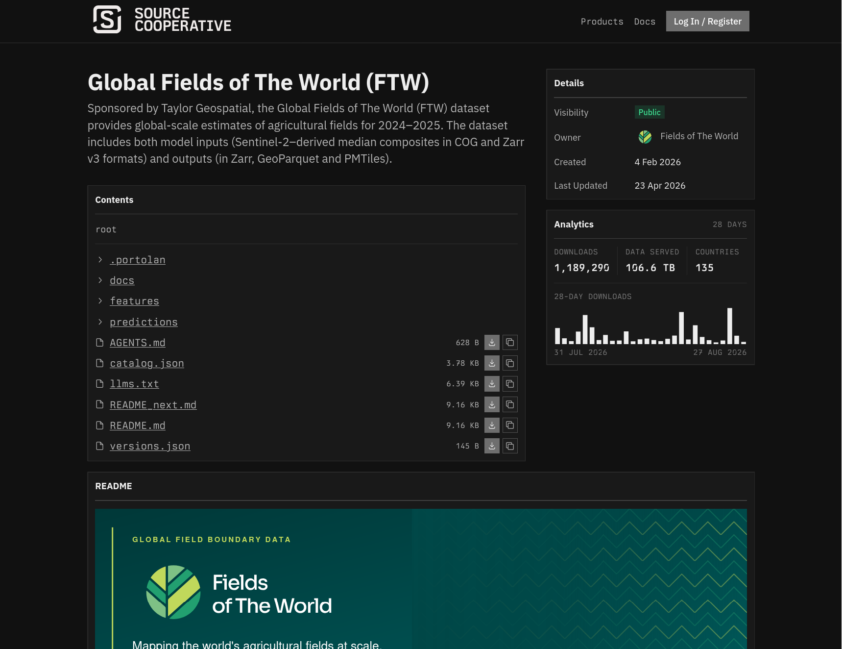
Fields of the World is one example. Its global dataset of agricultural field boundaries is published as a Portolan catalog on object storage, with no serving layer in front of it.
The same shift matters at the other end of the spectrum. Many city governments, NGOs, researchers, and smaller data producers can't justify maintaining GeoServer , Esri infrastructure, or a custom API just to publish a handful of datasets. Because a Portolan catalog is just files in a bucket, it lowers the technical and financial barriers to publishing useful geospatial data.
With Portolan, your data live in any S3-compatible cloud storage, in any jurisdiction you choose. Changing providers does not change the file formats or catalog structure. This gives publishers flexibility to meet sovereignty requirements.
For data users, Portolan provides a faster, more consistent way to access data. Portolan catalogs use formats that already work out of the box with tools like QGIS, ArcGIS, DuckDB , and Python, but cloud-optimized formats permit much faster access than WFS endpoints or Esri servers ever could. Portolan catalogs also necessarily include the metadata and documentation needed to understand what the data contain and how they should be used. The registry adds a common place to discover public catalogs.
Portolan in practice
The Portolan specification can be implemented in a number of ways, but we've built a set of tools to make publishing and working with Portolan data easy.
First, rashid , our validator, checks catalogs against the Portolan specification. It reports failures against MUST requirements and warnings against SHOULD requirements, and outputs agent-friendly JSON that makes it straightforward for a person or agent to bring a catalog into conformance.
The Portolan CLI handles the deterministic work underneath the broader publishing workflow, including ingesting source data, converting it into cloud-optimized formats, managing catalog structure and metadata, and publishing finished catalogs to object storage.
On top of those tools, we provide
agent skills that can
orchestrate publication from start to finish.
portolan-bootstrap ,
for example, can start with a folder of files, a WFS endpoint, an Esri service,
or another published dataset, then work through catalog structure, conversion,
documentation, visualization, validation, and publication.
A terminal recording shows an agent create and publish a Portolan catalog from ten Open Data Philly housing datasets. It converts source data, adds documentation and map styles, validates the catalog, and publishes the finished files.
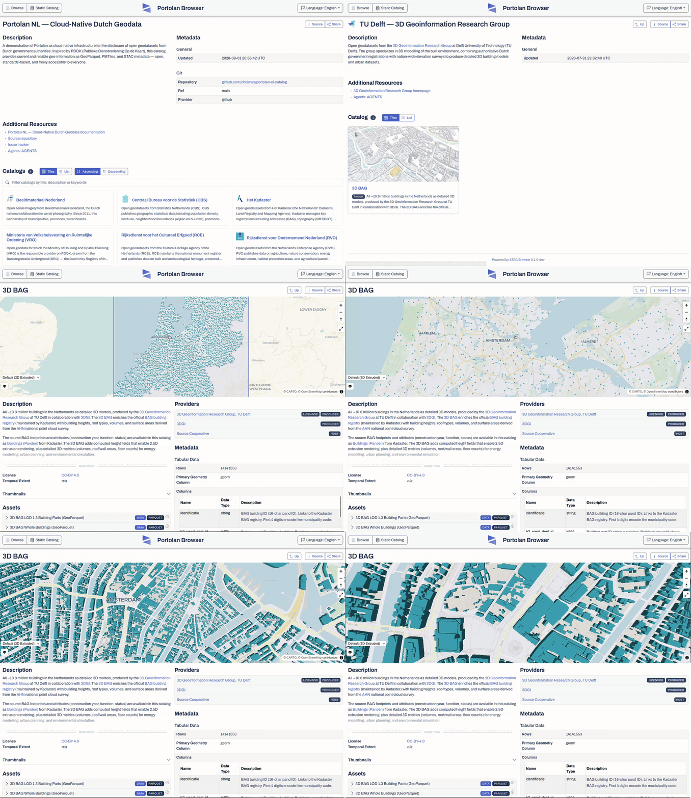
Because Portolan catalogs are built from existing standards, using them doesn't require any Portolan-specific tooling. You can explore the same data in the Portolan browser, query them directly from QGIS, ArcGIS, Python, or DuckDB, or hand the catalog to an agent. They fit into existing workflows and can be combined freely with data published elsewhere. We also provide skills for agents consuming Portolan data, with guidance on navigating STAC metadata, querying GeoParquet and COG efficiently, joining datasets, and building analyses or applications from the results.
Built for people and agents
Agents make it viable to work with geospatial data at a scale that was previously impractical. They can search across catalogs, inspect hundreds of assets, combine datasets from different publishers, and iterate through an analysis in the time it'd take a person to navigate a few portals. That opens up much more ambitious uses of public geospatial data, but only if the underlying infrastructure is built for them.
Portolan catalogs are designed for agent-friendly access. Cloud storage and cloud-optimized formats can handle the much higher query volumes agents generate, while STAC metadata and strong documentation give them a consistent way to discover data and use it correctly. Publishers can also encode expertise alongside the data, including caveats, appropriate-use guidance, and other context that'd otherwise be scattered across documentation or live only in the heads of domain experts.
A terminal recording shows an agent search the Portolan registry for Moldova flood data, inspect related catalogs, estimate exposed buildings and population, and rank planning corridors.
This also reduces the expertise required simply to get at the data. Users should be able to focus on asking useful questions rather than learning the quirks of several portals, managing API pagination, wrangling downloads, or writing geospatial code just to get started. Agents can take on much of that intermediate work, broadening access for new users while letting experienced practitioners work across far more data than they could reasonably manage by hand.
Toward a federated network
Our long-term goal is for Portolan to become the default way of publishing geospatial data. If national mapping agencies, cities, researchers, NGOs, and global data providers publish interoperable, well-documented catalogs in the same basic shape, datasets can remain distributed across thousands of publishers while becoming consistently searchable and directly usable across organizational and geographic boundaries.
The Portolan registry is the first step toward that network. It's deliberately nothing more than a catalog of independently hosted catalogs. Any publisher can submit a catalog and, once it passes validation, make it discoverable alongside data from other publishers. The underlying bytes never leave the publisher's storage; users continue to query them directly from the source. Even if the registry disappeared tomorrow, every registered catalog would keep working.
The network has already started to take shape, with catalogs spanning global datasets , national government data , and community mirrors . As it grows, discovery starts to work very differently. A person or agent can begin with nothing more than the URL of the registry, find relevant datasets across many publishers, understand how they're structured, and query them directly from the source. You can already point an agent at the registry and see what it can do, with no instructions about individual portals or APIs. Our ambition is to make that kind of access possible across a substantial share of the world's published geospatial data.
What comes next
Portolan is still early stage; right now, we're focused on polishing the specification and building out the core tooling and reference implementation. Our approach is to learn by doing: publish useful Portolan catalogs, see what works across real datasets and publishers, and feed those lessons back into the specification and tooling. Because we expect breaking changes in the short term, Portolan is currently best suited to early adopters. The roadmap lists the work in each stage.
The Portolan registry is one useful measure of our progress. The more kinds of data, publishers, formats, and use cases represented there, the more confident we can be that Portolan works across the geospatial ecosystem. Our initial goal is roughly one hundred reference catalogs, covering a range of use cases and geographic extents.
Other important signs of maturity are stability in the specification and core tooling. We want to reach a point where real-world use no longer routinely exposes gaps that require breaking specification changes, and where publishers can create and maintain conformant catalogs with a stable v1.0 CLI. After the core reaches that point, we'll focus more heavily on expanding the tooling ecosystem and making Portolan accessible to publishers and users who don't work from the command line.
Beyond that, success means an ecosystem forming around the specification rather than Portolan depending on the tools we build ourselves. We want to see community and commercial implementations add new capabilities, and existing GIS tools and data platforms read Portolan metadata directly. At that point, publishers should be able to choose among different tools and workflows while producing catalogs that remain interoperable.
Get involved
The best way to participate in building Portolan right now is to publish data as Portolan catalogs, test the tooling, and let us know what works and what doesn't. We're still learning from the different ways people implement the spec, so testing Portolan against new datasets, publishers, and workflows is especially valuable. If you work for an organization that publishes geospatial data, we'd love to see more official Portolan catalogs. If you just want to help, grab an open issue from our list of datasets we'd like to mirror into the Portolan registry. We also welcome contributions to the spec and tooling through bug reports, feature requests, and PRs (especially PRs).
Portolan is being built as an open-source community project. To get involved,
join the #portolan channel
in the Cloud-Native Geospatial Forum Slack workspace or the
Google Group , where we
organize weekly meetings on Fridays at 10am CET. The specification,
documentation, examples, registry, and current catalogs are at
portolan-sdi.org , and the code lives in the
Portolan GitHub organization .
Acknowledgements
Portolan is developed by a growing group of contributors, led by technical lead Nissim Lebovits , with major contributions from Cayetano Benavent , Youssef Harby , Chris Holmes , Matthias Mohr , and Javier de la Torre .
The project has been supported and shaped from the start by Radiant Earth , CARTO , Planet , Taylor Geospatial , Source Cooperative , and walkthru.earth . We're also grateful to PDOK , the City of Madrid , Barcelona , and the Municipality of Pergamino for opening up data and working with us on real-world catalogs and use cases.